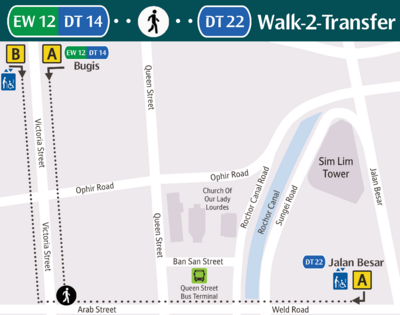
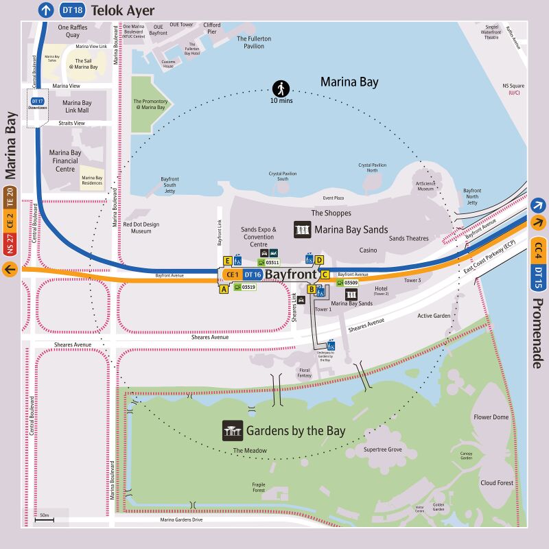
Alternative Travel Method/Bayfront
From SgWiki
Jump to navigation
Jump to search
Notes
- The suggested route assumed that there is no train disruption on the rest of the MRT network.
- The list of bus service plying between the bus stops are listed accordingly by their similar travelling time and not by the origin-destination pair.
- Stay updated to road closures that may affect bus routes in Bayfront during major events. Other train options are available at within walking distance.NS27CE2TE20NS27CE2TE20
Circle Line[edit]
Dhoby Ghaut to MacPherson[edit]
| Going To | Route(s) | Estimated Travel Time (mins) |
Expand | |||||||||
|---|---|---|---|---|---|---|---|---|---|---|---|---|
NS24 NE6 CC1 NS24 NE6 CC1 |
|
10 ~ 30 | ||||||||||
CC2 |
|
10 ~ 25 | ||||||||||
CC3 |
|
10 ~ 25 | ||||||||||
CC4 DT15 CC4 DT15 |
CE1 DT16 CE1 DT16 Downtown Line [ 3 ~ 9 mins ] CC4 DT15 CC4 DT15 |
3 ~ 9 | ||||||||||
CC5 Nicoll Highway
|
CE1 DT16 CE1 DT16 Downtown Line [ 5 ~ 11 mins ] DT14 EW12 Bugis 01511 Opp The Gateway Beach Rd | EW12 DT14 BugisGuoco Midtown D 100 961 961M 980 [ 5 ~ 20 mins ] 01411 Opp St. John HQ Beach Rd | A |
15 ~ 36 | ||||||||
CC6 Stadium
|
CE1 DT16 CE1 DT16 Downtown Line [ 5 ~ 11 mins ] DT14 EW12 Bugis East–West Line [ 5 ~ 10 mins ] EW10 80009 Lor 1 Geylang Ter Lor 1 Geylang | EW10 A 11 [ 10 ~ 30 mins ] 80199 Stadium Stn Stadium Cres | CC6 StadiumNational Stadium Singapore Indoor Stadium A
|
25 ~ 56 | ||||||||
CC7 Mountbatten
|
CE1 DT16 CE1 DT16 Downtown Line [ 5 ~ 11 mins ] DT14 EW12 Bugis East–West Line [ 5 ~ 10 mins ] EW10 80031 Kallang Stn Sims Ave | EW10 A 12 32 33 [ 10 ~ 25 mins ] 80149 S.A. Deaf Mountbatten Rd | A |
22 ~ 48 | ||||||||
CC8 |
|
27 ~ 54 | ||||||||||
EW8 CC9 EW8 CC9 |
CE1 DT16 CE1 DT16 Downtown Line [ 5 ~ 11 mins ] DT14 EW12 Bugis East–West Line [ 10 ~ 15 mins ] EW8 CC9 EW8 CC9 |
15 ~ 26 | ||||||||||
CC10 DT26 CC10 DT26 |
CE1 DT16 CE1 DT16 Downtown Line [ 22 ~ 28 mins ] CC10 DT26 CC10 DT26 |
22 ~ 28 | ||||||||||
Tai Seng to Botanic Gardens[edit]
| Going To | Route(s) | Estimated Travel Time (mins) |
Expand | |||||||||
|---|---|---|---|---|---|---|---|---|---|---|---|---|
CC11 |
CE1 DT16 CE1 DT16 Downtown Line [ 22 ~ 28 mins ] CC10 DT26 CC10 DT26 70251 MacPherson Stn Exit C Paya Lebar Rd | CC10 DT26 C 24 28 43 70 70M 76 80 [ 5 ~ 15 mins ] 70281 Aft Tai Seng Stn Upp Paya Lebar Rd | CC11 18 Tai Seng A |
32 ~ 48 | ||||||||
CC12 |
|
37 ~ 58 | ||||||||||
NE12 CC13 |
CE1 DT16 CE1 DT16 Downtown Line [ 7 ~ 13 mins ] NE7 DT12 NE7 DT12 North East Line [ 12 ~ 18 mins ] NE12 CC13 |
37 ~ 58 | ||||||||||
CC14 |
|
30 ~ 67 | ||||||||||
NS17 CC15 NS17 CC15 |
CE1 DT16 CE1 DT16 Downtown Line [ 11 ~ 17 mins ] NS21 DT11 NS21 DT11 North–South Line [ 9 ~ 14 mins ] NS17 CC15 NS17 CC15 |
21 ~ 31 | ||||||||||
CC16 |
CE1 DT16 CE1 DT16 Downtown Line [ 14 ~ 20 mins ] DT10 TE11 DT10 TE11 Thomson–East Coast Line [ 8 ~ 13 mins ] 53059 Upp Thomson Stn Exit 2 Upp Thomson Rd | Thomson Plaza 2 410W [ 5 ~ 15 mins ] 53129 Opp Marymount Stn Marymount Rd | CC16 A |
32 ~ 53 | ||||||||
CC17 TE9 CC17 TE9 |
CE1 DT16 CE1 DT16 Downtown Line [ 14 ~ 20 mins ] DT10 TE11 DT10 TE11 Thomson–East Coast Line [ 4 ~ 9 mins ] CC17 TE9 CC17 TE9 |
18 ~ 29 | ||||||||||
CC19 DT9 CC19 DT9 |
CE1 DT16 CE1 DT16 Downtown Line [ 16 ~ 22 mins ] CC19 DT9 CC19 DT9 |
16 ~ 22 | ||||||||||
Farrer Road to HarbourFront[edit]
| Going To | Route(s) | Estimated Travel Time (mins) |
Expand | ||||||||
|---|---|---|---|---|---|---|---|---|---|---|---|
CC20 |
CE1 DT16 CE1 DT16 Downtown Line [ 16 ~ 22 mins ] CC19 DT9 CC19 DT9 41021 Botanic Gdns Stn Bt Timah Rd | CC19 DT9 Singapore Botanic Gardens A B 48 153 186 [ 5 ~ 20 mins ] 11119 Farrer Rd Stn Exit A Farrer Rd | CC20 A |
26 ~ 47 | |||||||
CC21 Holland Village
|
CE1 DT16 CE1 DT16 Downtown Line [ 16 ~ 22 mins ] CC19 DT9 CC19 DT9 41021 Botanic Gdns Stn Bt Timah Rd | CC19 DT9 Singapore Botanic Gardens A B 48 [ 10 ~ 25 mins ] 11419 Holland V Stn Exit A Holland Ave | CC21 Holland Village B |
31 ~ 52 | |||||||
EW21 CC22 EW21 CC22 |
CE1 DT16 CE1 DT16 Downtown Line [ 6 ~ 12 mins ] NE4 DT19 NE4 DT19 North East Line [ 2 ~ 8 mins ] EW16 NE3 TE17 EW16 NE3 TE17 East–West Line [ 12 ~ 17 mins ] EW21 CC22 EW21 CC22 |
20 ~ 37 | |||||||||
CC23 one-north
|
CE1 DT16 CE1 DT16 Downtown Line [ 6 ~ 12 mins ] NE4 DT19 NE4 DT19 North East Line [ 2 ~ 8 mins ] EW16 NE3 TE17 EW16 NE3 TE17 East–West Line [ 12 ~ 17 mins ] EW21 CC22 EW21 CC22 11369 Buona Vista Stn Exit D Nth Buona Vista Rd | EW21 CC22 EW21 CC22 D 191 [ 5 ~ 25 mins ] 18151 Opp one-north Stn/Galaxis Portsdown Rd B |
30 ~ 67 | ||||||||
CC24 Kent Ridge
|
|
35 ~ 67 | |||||||||
CC25 Haw Par Villa
|
|
35 ~ 62 | |||||||||
CC26 Pasir Panjang
|
|
30 ~ 57 | |||||||||
CC27 Labrador Park
|
|
25 ~ 50 | |||||||||
CC28 Telok Blangah
|
|
25 ~ 50 | |||||||||
NE1 CC29 NE1 CC29 |
CE1 DT16 CE1 DT16 Downtown Line [ 6 ~ 12 mins ] NE4 DT19 NE4 DT19 North East Line [ 6 ~ 12 mins ] NE1 CC29 NE1 CC29 |
12 ~ 24 | |||||||||
Marina Bay[edit]
| Going To | Route(s) | Estimated Travel Time (mins) |
Expand | ||||
|---|---|---|---|---|---|---|---|
NS27 CE2 TE20 NS27 CE2 TE20 |
|
5 ~ 20 | |||||
Downtown Line[edit]
Bukit Panjang to Stevens[edit]
| Going To | Route(s) | Estimated Travel Time (mins) |
Expand | ||||||||||
|---|---|---|---|---|---|---|---|---|---|---|---|---|---|
DT1 BP6 DT1 BP6 |
CE1 DT16 CE1 DT16 Circle Line [ 2 ~ 7 mins ] NS27 CE2 TE20 NS27 CE2 TE20 Thomson–East Coast Line [ 19 ~ 24 mins ] DT10 TE11 DT10 TE11 40221 Stevens Stn Exit 3 Stevens Rd | DT10 TE11 3 190 [ 20 ~ 30 mins ] 44259 Blk 183 Bt Panjang Rd | C |
46 ~ 66 | |||||||||
DT2 Cashew
|
CE1 DT16 CE1 DT16 Circle Line [ 2 ~ 7 mins ] NS27 CE2 TE20 NS27 CE2 TE20 Thomson–East Coast Line [ 19 ~ 24 mins ] DT10 TE11 DT10 TE11 40081 Stevens Stn Exit 1 Bt Timah Rd | DT10 TE11 1 67 170 [ 30 ~ 45 mins ] 43091 Bef Cashew Stn Upp Bt Timah Rd | DT2 Cashew A |
56 ~ 81 | |||||||||
DT3 |
CE1 DT16 CE1 DT16 Circle Line [ 2 ~ 7 mins ] NS27 CE2 TE20 NS27 CE2 TE20 Thomson–East Coast Line [ 19 ~ 24 mins ] DT10 TE11 DT10 TE11 40081 Stevens Stn Exit 1 Bt Timah Rd | DT10 TE11 1 67 170 [ 30 ~ 45 mins ] 43061 Hillview Stn Upp Bt Timah Rd | DT3 A |
56 ~ 81 | |||||||||
DT5 |
|
43 ~ 76 | |||||||||||
DT6 King Albert Park
|
|
46 ~ 71 | |||||||||||
DT7 Sixth Avenue
|
|
41 ~ 66 | |||||||||||
DT8 Tan Kah Kee
|
|
36 ~ 61 | |||||||||||
CC19 DT9 CC19 DT9 |
CE1 DT16 CE1 DT16 Circle Line [ 2 ~ 7 mins ] NS27 CE2 TE20 NS27 CE2 TE20 Thomson–East Coast Line [ 19 ~ 24 mins ] DT10 TE11 DT10 TE11 40239 Bef Stevens Stn Exit 4 Whitley Rd | DT10 TE11 4 151 153 154 156 186 [ 5 ~ 15 mins ] 41021 Botanic Gdns Stn Bt Timah Rd | CC19 DT9 Singapore Botanic Gardens A B |
31 ~ 51 | |||||||||
DT10 TE11 DT10 TE11 |
CE1 DT16 CE1 DT16 Circle Line [ 2 ~ 7 mins ] NS27 CE2 TE20 NS27 CE2 TE20 Thomson–East Coast Line [ 19 ~ 24 mins ] DT10 TE11 DT10 TE11 |
21 ~ 31 | |||||||||||
Newton to Chinatown[edit]
| Going To | Route(s) | Estimated Travel Time (mins) |
Expand | ||||||||
|---|---|---|---|---|---|---|---|---|---|---|---|
NS21 DT11 NS21 DT11 |
CE1 DT16 CE1 DT16 Circle Line [ 2 ~ 7 mins ] NS27 CE2 TE20 NS27 CE2 TE20 North–South Line [ 13 ~ 18 mins ] NS21 DT11 NS21 DT11 |
15 ~ 25 | |||||||||
NE7 DT12 NE7 DT12 |
CE1 DT16 CE1 DT16 Circle Line [ 2 ~ 7 mins ] NS27 CE2 TE20 NS27 CE2 TE20 North–South Line [ 7 ~ 12 mins ] NS24 NE6 CC1 NS24 NE6 CC1 North East Line [ 2 ~ 8 mins ] NE7 DT12 NE7 DT12 |
11 ~ 27 | |||||||||
DT13 Rochor
|
CE1 DT16 CE1 DT16 Circle Line [ 2 ~ 7 mins ] NS27 CE2 TE20 NS27 CE2 TE20 North–South Line [ 2 ~ 7 mins ] NS26 EW14 NS26 EW14 East–West Line [ 4 ~ 9 mins ] EW12 DT14 Bugis 07551 Fu Lu Shou Cplx Rochor Rd | A 48 57 170 851 960 980 [ 5 ~ 15 mins ] 07531 Rochor Stn Rochor Canal Rd | DT13 Rochor A |
18 ~ 43 | |||||||
DT14 EW12 Bugis
|
|
15 ~ 30 | |||||||||
CC4 DT15 CC4 DT15 |
CE1 DT16 CE1 DT16 Circle Line [ 3 ~ 8 mins ] CC4 DT15 CC4 DT15 |
3 ~ 8 | |||||||||
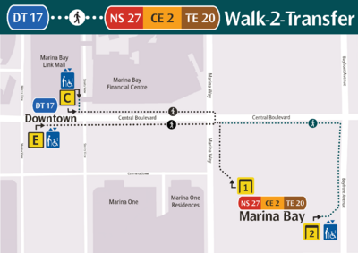
DT17 |
|
7 ~ 21 | |||||||||
DT18 |
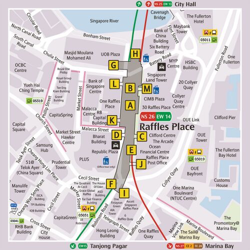
CE1 DT16 CE1 DT16 Circle Line [ 2 ~ 7 mins ] NS27 CE2 TE20 NS27 CE2 TE20 North–South Line [ 2 ~ 7 mins ] NS26 EW14 NS26 EW14 F M DT18 A
|
10 ~ 20 | |||||||||
NE4 DT19 NE4 DT19 |
CE1 DT16 CE1 DT16 Circle Line [ 2 ~ 7 mins ] NS27 CE2 TE20 NS27 CE2 TE20 Thomson–East Coast Line [ 6 ~ 11 mins ] EW16 NE3 TE17 EW16 NE3 TE17 North East Line [ 2 ~ 8 mins ] NE4 DT19 NE4 DT19 |
10 ~ 26 | |||||||||
Fort Canning to Bedok Reservoir[edit]
| Going To | Route(s) | Estimated Travel Time (mins) |
Expand | ||||||||||
|---|---|---|---|---|---|---|---|---|---|---|---|---|---|
DT20 Fort Canning
|
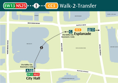
CE1 DT16 CE1 DT16 Circle Line [ 2 ~ 7 mins ] NS27 CE2 TE20 NS27 CE2 TE20 North–South Line [ 4 ~ 9 mins ] NS25 EW13 NS25 EW13 04168 Aft City Hall Stn Exit B Nth Bridge Rd | NS25 EW13 Funan National Gallery Singapore B 32 195 [ 5 ~ 20 mins ] 04331 Bef Fort Canning Stn River Valley Rd | DT20 Fort CanningFort Canning Park A |
16 ~ 36 | |||||||||
DT21 |
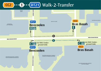
CE1 DT16 CE1 DT16 Circle Line [ 3 ~ 8 mins ] CC4 DT15 CC4 DT15 Circle Line [ 4 ~ 9 mins ] CC2 C Walk through SMU Underground Link[ 5 mins ] DT21 C
|
12 ~ 22 | |||||||||||
DT22 Jalan Besar
|
|
18 ~ 40 | |||||||||||
DT23 Bendemeer
|
|
19 ~ 49 | |||||||||||
DT24 Geylang Bahru
|
|
24 ~ 54 | |||||||||||
DT25 Mattar
|
CE1 DT16 CE1 DT16 Circle Line [ 3 ~ 8 mins ] CC4 DT15 CC4 DT15 Circle Line [ 13 ~ 18 mins ] CC10 DT26 CC10 DT26 70379 Opp MacPherson Stn Exit A Circuit Lk | CC10 DT26 A 61 63 65 135 154 158 [ 5 ~ 10 mins ] 70231 Opp Mattar Stn Exit B Mattar Rd | DT25 Mattar B |
26 ~ 41 | |||||||||
CC10 DT26 CC10 DT26 |
CE1 DT16 CE1 DT16 Circle Line [ 3 ~ 8 mins ] CC4 DT15 CC4 DT15 Circle Line [ 13 ~ 18 mins ] CC10 DT26 CC10 DT26 |
16 ~ 26 | |||||||||||
DT27 Ubi
|
CE1 DT16 CE1 DT16 Circle Line [ 3 ~ 8 mins ] CC4 DT15 CC4 DT15 Circle Line [ 13 ~ 18 mins ] CC10 DT26 CC10 DT26 70371 MacPherson Stn Exit A Circuit Lk | CC10 DT26 A 61 65 [ 5 ~ 20 mins ] 71121 Ubi Stn Exit B Ubi Ave 2 | DT27 Ubi B |
26 ~ 51 | |||||||||
DT28 Kaki Bukit
|
|
25 ~ 56 | |||||||||||
DT29 Bedok North
|
|
20 ~ 68 | |||||||||||
DT30 Bedok Reservoir
|
|
42 ~ 72 | |||||||||||
Tampines West to Expo[edit]
| Going To | Route(s) | Estimated Travel Time (mins) |
Expand | ||||||||||||
|---|---|---|---|---|---|---|---|---|---|---|---|---|---|---|---|
DT31 Tampines West
|
|
30 ~ 77 | |||||||||||||
EW2 DT32 |
CE1 DT16 CE1 DT16 Circle Line [ 3 ~ 8 mins ] CC4 DT15 CC4 DT15 Circle Line [ 11 ~ 16 mins ] EW8 CC9 EW8 CC9 East–West Line [ 17 ~ 22 mins ] EW2 DT32 |
31 ~ 46 | |||||||||||||
DT33 Tampines East
|
|
40 ~ 66 | |||||||||||||
DT34 |
|
37 ~ 69 | |||||||||||||
CG1 DT35 CG1 DT35 |
|
28 ~ 75 | |||||||||||||
Locality Map[edit]
See Also[edit]
| [ V • T • E ] | ||
|---|---|---|
| Stations | Dhoby Ghaut • Bras Basah • Esplanade • Promenade • Nicoll Highway • Stadium • Mountbatten • Dakota • Paya Lebar • MacPherson • Tai Seng • Bartley • Serangoon • Lorong Chuan • Bishan • Marymount • Caldecott • Bukit Brown • Botanic Gardens • Farrer Road • Holland Village • Buona Vista • one-north • Kent Ridge • Haw Par Villa • Pasir Panjang • Labrador Park • Telok Blangah • HarbourFront | |
| CCL6Keppel • Cantonment • Prince Edward Road | ||
| Circle Line ExtensionPromenade • Bayfront • Marina Bay | ||
| Rolling Stock | 830 • 830C • 851E | |
| Depots | Kim Chuan | |
| Others | Bridging Service | |
| [ V • T • E ] | ||
|---|---|---|
| Stations | Bukit Panjang • Cashew • Hillview • Hume • Beauty World • King Albert Park • Sixth Avenue • Tan Kah Kee • Botanic Gardens • Stevens • Newton • Little India • Rochor • Bugis • Promenade • Bayfront • Downtown • Telok Ayer • Chinatown • Fort Canning • Bencoolen • Jalan Besar • Bendemeer • Geylang Bahru • Mattar • MacPherson • Ubi • Kaki Bukit • Bedok North • Bedok Reservoir • Tampines West • Tampines • Tampines East • Upper Changi • Expo | |
| DTL3eXilin • Sungei Bedok | ||
| Rolling Stock | 951 | |
| Depots | Gali Batu • Kim Chuan • East Coast | |
| Others | Bridging Service | |
